Tuesday, March 29, 2016

Cerro San Cristobal, Santiago


Cerro San Cristóbal is a hill in Northern Santiago which consists of a large recreation area with many short walks through the park.

At its summit there is the immaculate conception statue and an amphitheatre for outdoor religious events.

The walk begins at the foot of the hill in the Providencia district and snakes around the hill along steep roads which are busy with bike and jogging traffic.

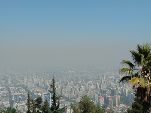
Various lookouts along the way give a view of Santiago, including its ever present smog.

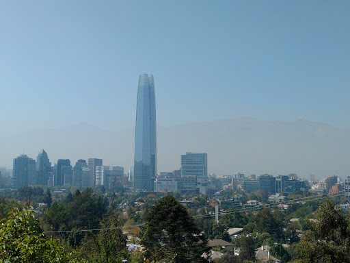
The Costanera centre and surrounds from the lookout

The steep roads continue to climb up the hill for a further few kilometres until they reach the summit where there are several shops, another lookout and the entrance to the Santiago Fernicular (which, obviously can save an hour's trekking to the summit).
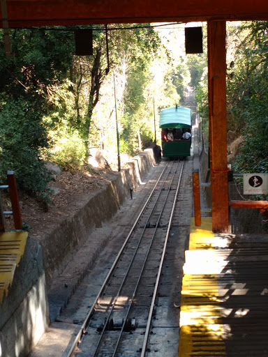
Santiago Fernicular

The views from the lookouts give a panoramic view of the city.
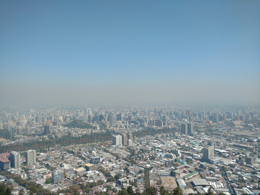
Santiago

In addition to the views there are shops selling touristy stuff, snacks and a traditional Chilean beverage: Mote con huesilos.
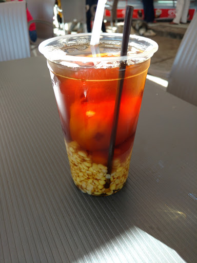
Mote con huesilos

The drink consists of dried peaches and husked wheat served in peach nectar with spices (such as cinnamon). It is gum curlingly sweet and I can't say I was a fan. However, there were some surprisingly good epanadas to make up for the interesting flavoured beverage. At least it gave me the energy for the final climb up the stairs to the immaculate conception statue.

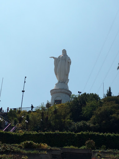
Looking up the hill to the statue

The statue of the Blessed Virgin Mary stands 22 metres tall at the summit of the hill. Within the pedestal is a small chapel 

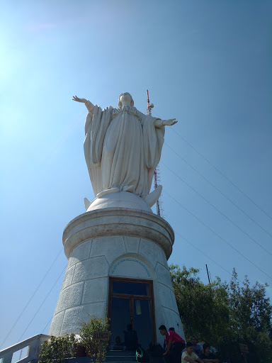
The statue of the Blessed Virgin Mary with the chapel in the pedestal

Strangely there are also many mobile phone towers behind the statue that ruin the scenery somewhat.

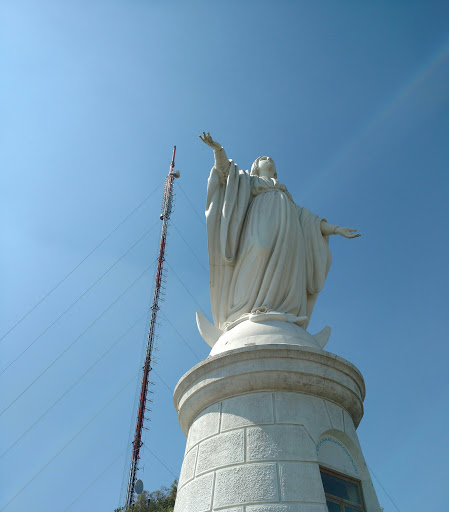
The statue of Immaculate Conception and the Mobile Tower of Immaculate Reception


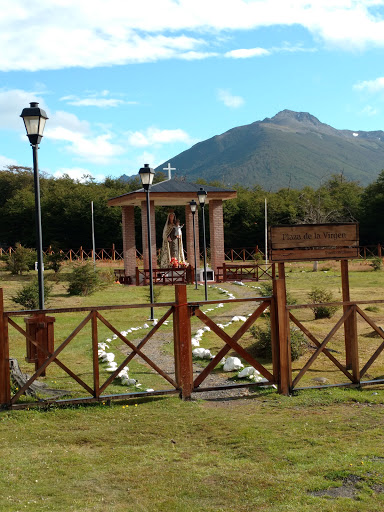
There is also a small church and amphitheatre near the statue for religious services.
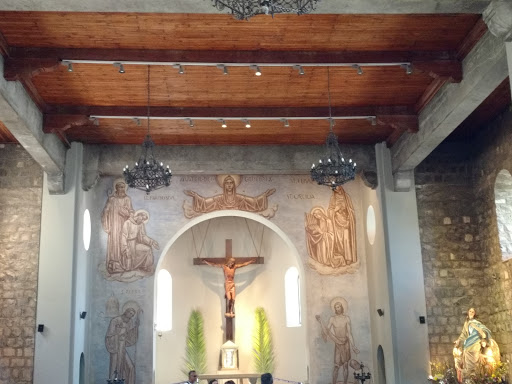
Inside the church


From the statue you can also get great views of Santiago.

Santiago from the top of Cerro San Cristobal


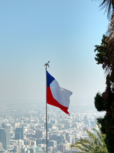
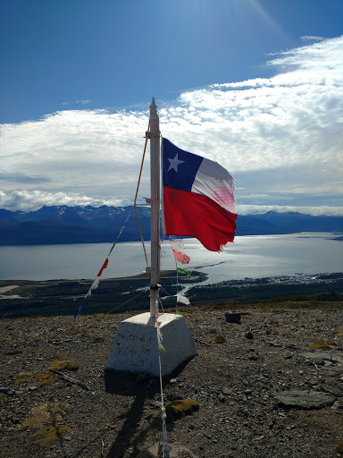
Another view of Santiago with the Chilean flag

Instead of walking back, I decided to take the lazy option of the fernicular back down the hill.

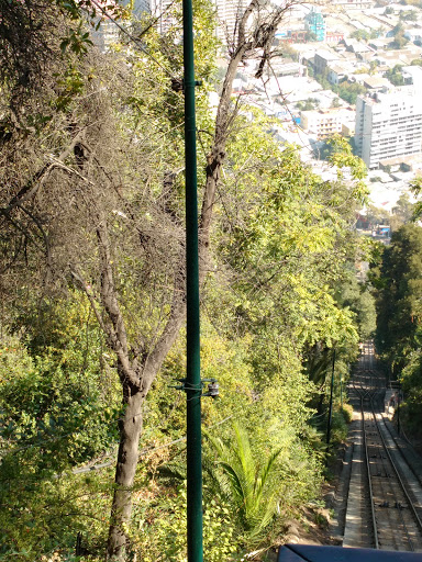
Heading back via the fernicular

Friday, March 25, 2016

A brief stop in Punta Arenas

Punta Arenas

Punta Arenas is a small town in Chilean Patagónia. It serves mainly as a port and as a transit point to the Torres del Paine national park.

It is a very sleepy town with few attractions within the town itself, however it is known for a historic fort and a large Penguin colony. 

Sadly, I'd been struck down by a cold and so I restricted my activities to the town rather than take a bus to these attractions.
In the centre of town there is a main Plaza with a small artisan market and a statue of Magellan. Apparently if you touch the statue you will return to Punta Arenas.

Magellan's Statue

The town also has a long boardwalk that runs all along the foreshore, however, sadly it is not well maintained and parts of it are heavily graffitied and damaged. At least it dies provide nice views of the beach.

Punta Arenas beach

In the hills behind the town is a lookout that gives a vista across the whole city.

Punta Arenas from Avenida San Cristobal

Punta Arenas from the lookout

Punta Arenas casino next to the sea from the lookout

The town is also known for its well-maintained historic cemetery. It is similar in style to the Recoleta cemetery in Buenos Aires and like there, houses many historic figures from the town. The interesting thing about the Punta Arenas cemetery is the variety of origins if the people buried here. There were large numbers of Eastern European (especially Croatian) names as well as many English, Jewish and German graves.

A Croatian family vault

The Punta Arenas cemetery

The final thing Punta Arenas is known for is its beers - the Austral brewery is in Punta Arenas and it manufacturers the very delicious Calafate larger - a beer flavoured with Calafate berries. I'm not usually a fan of flavoured beer - but this one is a winner :)

Austral Calafate Ale

Tuesday, March 22, 2016

The straits of Magellan by ferry: Puerto Williams to Punta Arenas

The ferry Yaghan
The ferry from Puerto Williams to Punta Arenas is a 30 hour ferry ride through the Beagle Channel and the Magellanic straits.

The ferry is a commuter and goods ferry, so it is not designed as a tour - however the scenery makes it an unforgettable experience.

The ferry itself is functional and comfortable with fully reclinable bed seats which were long enough even for me and quite comfortable. The food is basic, but tasty, but you don't take the ferry for luxury.
A reasonably tasty spag bol
The trip starts through the Beagle channel heading north towards Ushuaia. During this trip, the ferry was joined by many animals, including Orcas (which sadly dived before I could photograph them), Penguins and sealions.
A sealion
The ferry also startled many birds who took off as the boat approached.
A Cormorant flies off
The ferry starts by travelling up the Beagle Channel through fairly calm waters.
A fellow traveler on the Beagle Channel
As the ferry leaves at four in the afternoon, the slow sunset over the channel provides a beautiful backdrop to the cruise.
Sunset over the Beagle Channel

The mouth of the Beagle Channel
The ferry then turns out of the Beagle Channel and into more open seas over night.
My view first thing in the morning
Where the sea is a lot rougher 
Rough seas
However, once the ferry entered the Magellanic straits, the sea calmed as it passed the southernmost tip of the South American continent.
Entering the straits
There is a giant white cross which marks the southernmost point.
The tip of the South American continent
The ferry continues towards Punta Arenas as the sun goes down over the Magellanic straits and arrives around 10pm in the evening to Punta Arenas, allowing passengers a final sunset on the sea.
Sunset with Punta Arenas in the distance

Saturday, March 19, 2016

Cerro Bandera, Puerto Williams

The Bandera
The Cerro Bandera trail is the first part of the Dientes de Navarino trail in Puerto Williams.

It's easily accessible from the town, with a short 40 min walk to the main road to the Aerodrome and Puerto Navarino. The trail starts along the road to the town water supply where the road splits at Plaza de la Virgen.
The Plaza de la Virgen
From the town water supply, the trail heads into the forest of Northofagus trees that are typical of the area.
The start of the trail
The path climbs steeply up the hill until it reaches the first of the lookouts. From here you can see Puerto Williams, the Beagle Channel and far in the distance, Ushuaia.
Puerto Williams
Looking up the Beagle Channel towards Ushuaia
From this lookout the trail becomes considerably steeper as it winds through further forest until you ascend past the treeline where there is a second lookout.
The Beagle Channel
Puerto Williams
The mountains
From here it's a very steep ascent to the flag at the top.
Steep trail to the top
The Bandera (flagpole) commands views across the valley to the Beagle Channel. 
The bandera with Puerto Williams and the Beagle Channel in the background
The trail continues up the mountain and from the H5 and H6 waypoints you can get beautiful views of the lagoons, mountains and river.
The mountains and lagoon

The lagoon
The mountains (aka Los Dientes)
The river at waypoint H6
The trail follows the side of the mountain and is very steep and difficult terrain. Sadly I had run out of time to continue and it had started to rain - so the prospect of more mountain trekking was impractical.
The steep and difficult trail along the mountain
Looking back to the bandera with the weather closing in
The Beagle Channel from waypoint H5 (before it started raining)